
Sunday, May 2, 2021

Sunday, March 21, 2021
Sanborn County Park, Saratoga, CA
This is a pleasant, moderately steep forest hike.
There is a $6 vehicle entry fee.
Monday, September 7, 2020

Monday, July 6, 2020
Seal Point Park, San Mateo, CA
Great views of the bay. Best in summer as it gets somewhat breezy. Parking is easy and plentiful. Has a dog park as well.


Byxbee park, Palo Alto, CA
I took the family here for a short walk. It's not crowded here so social distancing (with mask) was not too difficult.


Sunday, April 7, 2019

Wednesday, April 3, 2019
Uvas Canyon County Park, Morgan Hill, CA
I recently went on this hike with my SO, after my uncle had suggested this park to me. A good place to go in early spring to see waterfalls.


Sunday, March 24, 2019
Baylands Park, Sunnyvale, CA
I went here on a Sunday afternoon with my brother. It is flat with a good view of the marshlands. Popular with drone operators.
Thursday, January 24, 2019

Monday, September 17, 2018


Monday, August 27, 2018
Morgan Territory Regional Preserve, Livermore, CA
Good for a weekend afternoon. Mt. Diablo is visible from the Volvon trail.

Note: getting to the park requires driving on a narrow 1-lane road. Exercise caution.

Note: getting to the park requires driving on a narrow 1-lane road. Exercise caution.
Tiger Mountain, Issaquah, WA
The hike to Poo Poo Point features a 1858-foot elevation gain in 3.5 miles (7-mile round trip).


Monday, July 2, 2018

Thursday, June 28, 2018

Monday, June 18, 2018
Sycamore Valley Regional Open Space Preserve
This park is not crowded, but not isolated either. Good for a 2-3 hour hike.


Saturday, June 9, 2018
Sunday, May 13, 2018
Ed R. Levin County Park
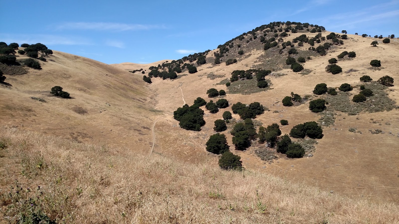
On a Sunday in early May, I hiked here. It features beautiful views of a lake and the bay.

Note: Certain trails in this park go near a cell phone tower. I turned back early to avoid it (possible EM radiation exposure risk).

Note: Certain trails in this park go near a cell phone tower. I turned back early to avoid it (possible EM radiation exposure risk).
Monday, May 7, 2018

Monday, April 30, 2018
Wilder Ranch State Park, Santa Cruz, CA
I took my wife here on a late April weekend. The hike was windy, but pretty.


Sunday, April 22, 2018


Monday, April 9, 2018
Shoreline Park to Byxbee Park, Mountain View, CA
Today I jogged between the two parks for a nice workout.


Sunday, April 8, 2018

Monday, March 26, 2018
Dublin Hills Regional Park, Dublin, CA
I went here for a walk/jog on a cloudy spring afternoon, and was lucky to make it back to the car before the bulk of the rain hit.


Monday, March 12, 2018
Copper Trail, Albuquerque, NM
On a work trip to Albuquerque, I was able to squeeze in a hike at Copper Trailhead.


Monday, February 19, 2018

Sunday, February 11, 2018
Vargas Regional Park
In early February I spent a couple hours on a Sunday afternoon at Vargas Regional Park.
Warning: The drive there traverses a narrow road...drive safely and watch for oncoming traffic.
Note: It gets very windy here (thanks to the Venturi effect).

Warning: The drive there traverses a narrow road...drive safely and watch for oncoming traffic.
Note: It gets very windy here (thanks to the Venturi effect).

Thursday, February 8, 2018
Alum Rock, San Jose, CA
I returned here in early February with my S.O. Here is the view from Eagle Rock.


Monday, December 18, 2017
Las Trampas Regional Wilderness, San Ramon, CA
Recently I went hiking in San Ramon. It is windy here during the late fall and the trail is steep, but scenic.


Sunday, September 17, 2017
Almaden Quicksilver County Park, San Jose, CA (Mockingbird Hill entrance)
On a late summer afternoon, I took a hike at Almaden Quicksilver County Park.

Trails: Virl O. Norton Trail, Hacienda Trail
Difficulty: >Medium (2.4 miles, hilly)

Trails: Virl O. Norton Trail, Hacienda Trail
Difficulty: >Medium (2.4 miles, hilly)
Monday, August 7, 2017


Thursday, July 13, 2017
Lands End to Golden Gate Bridge, San Francisco, CA
I took my special companion here on a Saturday afternoon. After a late lunch, we started our journey on the 1.5-mile Lands End Coastal trail, and decided to continue on to the Golden Gate Bridge, retracing our steps back to the starting point for a 7 1/2 mile round-trip hike.


Trails: Coastal Trail, El Camino Del Mar/Lincoln Blvd.
Difficulty: Moderate to Strenuous


Trails: Coastal Trail, El Camino Del Mar/Lincoln Blvd.
Difficulty: Moderate to Strenuous
Mussel Rock Beach Park, Daly City, CA
Recommended by my brother, this SF-area park is full of nice photo ops. Prepare to get wet if you venture near the rocks.


Wednesday, May 31, 2017
Mount Si, North Bend, WA
This strenuous hike is about an hour east of Seattle. It provides stunning views of Mt. Rainier.


Trail: Mt. Si Trail
Difficulty: Strenuous (7.6 miles out & back, 3277ft elevation change)


Trail: Mt. Si Trail
Difficulty: Strenuous (7.6 miles out & back, 3277ft elevation change)
Saturday, May 27, 2017
Phantom Lake, Bellevue, WA
This lake near Seattle makes for a nice spring walk.

Trail: Lake to Lake Trail
Difficulty: Easy to Moderate

Trail: Lake to Lake Trail
Difficulty: Easy to Moderate
Friday, May 26, 2017


Sunday, April 23, 2017
Lake Chabot Regional Park, Castro Valley, CA
This East bay hike was recently recommended to me, and I was pleasantly surprised. It features pretty views of Lake Chabot and the bay. Good for walking the dog if you have one.


Trail: Unnamed
Difficulty: Moderate (some slope, sun exposure, windy in certain areas)


Trail: Unnamed
Difficulty: Moderate (some slope, sun exposure, windy in certain areas)
Ravenswood Open Space Preserve, East Palo Alto, CA
Next to the Dumbarton bridge, this marshland has some opportunities for birdwatching, but is very isolated. Do not hike here alone.

Trail: Bay Trail
Difficulty: Moderate (isolated, windy)

Trail: Bay Trail
Difficulty: Moderate (isolated, windy)
Saturday, April 15, 2017
Los Trancos Open Space Preserve, Los Altos, CA
Hidden in the hills southwest of Los Altos, this hike features a creek in the middle of the woods.

The trail itself is flat and not very long, but it is somewhat isolated. Though signage is good one can still lose one's way. It is advisable to bring friends and a gps-capable device.
Trail: Lost Creek Trail
Difficulty: Moderate (isolation)

The trail itself is flat and not very long, but it is somewhat isolated. Though signage is good one can still lose one's way. It is advisable to bring friends and a gps-capable device.
Trail: Lost Creek Trail
Difficulty: Moderate (isolation)
Sunday, April 9, 2017
Joseph D. Grant County Park, Mount Hamilton, CA
I took a spur-of-the-moment hike here today.
The park features a lake and several trails leading up into the foothills adjacent to Mt. Hamilton. After walking around Grant lake, one can take the Halls Valley Trail up the foothills.
Grant Lake

Halls Valley trail: Note the cows grazing on the grassy hillside.

About halfway up the Halls Valley trail, 3 cows blocked the trail up ahead and stood their ground. Instead of waiting it out, I decided to turn back as it was getting late.
Trail: Halls Valley Trail
Difficulty: >Moderate (length, slope, secluded)
The park features a lake and several trails leading up into the foothills adjacent to Mt. Hamilton. After walking around Grant lake, one can take the Halls Valley Trail up the foothills.
Grant Lake

Halls Valley trail: Note the cows grazing on the grassy hillside.

About halfway up the Halls Valley trail, 3 cows blocked the trail up ahead and stood their ground. Instead of waiting it out, I decided to turn back as it was getting late.
Trail: Halls Valley Trail
Difficulty: >Moderate (length, slope, secluded)
Sunday, April 2, 2017
Greyhound Rock County Park, Davenport, CA
At the suggestion of one of my uncles, I decided to drive here and look around. The park itself is located about 15 miles north of Santa Cruz, along highway 1. After parking, take the paved road down to the beach, where you will be greeted by a beautiful view of the rock.

It can be helpful to time your visit with low tide.
Having already hiked earlier that day (see previous post), I decided not to climb onto Greyhound rock itself, and plan to return sometime in the not-too-distant future to do so.

It can be helpful to time your visit with low tide.
Having already hiked earlier that day (see previous post), I decided not to climb onto Greyhound rock itself, and plan to return sometime in the not-too-distant future to do so.
Pomponio State Beach, San Gregorio, CA
This beach is located 12 miles south of Half Moon Bay along Highway 1--a great place to spend an afternoon to escape one's daily concerns and unwind. It is not too crowded here, and you can get a nice, secluded view of the coastal bluffs and ocean if you walk far enough along the beach.


Subscribe to:
Posts (Atom)